The hydrology toolset in ArcMAP has multiple tools to model the way water flows. The knowledge of where water come from, where it is going and how it moves across land is valuable knowledge in the field of forestry and agriculture. I have worked with a few of these tools, and will present them as a trilogy on this blog: Fill, Flow Direction, and Flow Accumulation.
 Fill
Fill
The hydrology toolset in ArcMAP has multiple tools to model the way water flows. The knowledge of where water come from, where it is going and how it moves across land is valuable knowledge in the field of forestry and agriculture. I have worked with a few of these tools, and will present them as a trilogy on this blog: Fill, Flow Direction, and Flow Accumulation.
Fill
Sinks are depressions that traps water with nowhere to go except when overflowing. Sinks in a DEM can be the result of errors in the data, especially working with older data that is not from a LIDAR source, and the fill tool corrects these errors and model a more correct hydrologic landscape and flow of basins and streams. Because this tool corrects errors in an original DEM, you may not see much of a difference between the original DEM and the new fill layer, depending on the quality of the source.
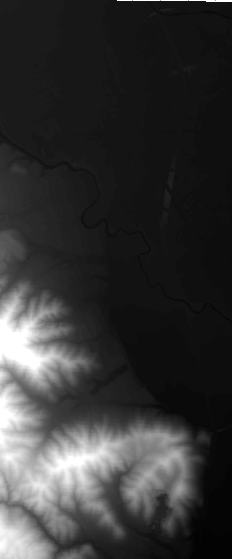
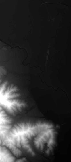
Left: Original DEM, Right: Fill
The fill tool use the elevation values of each cell to calculate the difference between the center cell and its neighbors. If the difference between the cells are more than the accuracy demands, the tool will adjust the value to the lowest value of the neighboring cells as a measure to fill what the tool has determined to be an erroneous sink. The tool continues to iterate over every cell until all sinks are filled. The fill tool can similarly be used to correct peaks in a DEM.
This is the first installment of the Hydrology trilogy, see part two and three.
This is the first installment of the Hydrology trilogy, see part two and three.